


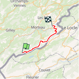
GTJ Les seignes- Villers le Lac

svp59
User

Length
23 km

Max alt
1291 m

Uphill gradient
598 m
Km-Effort
32 km

Min alt
751 m

Downhill gradient
886 m
Boucle
No
Creation date :
2014-12-10 00:00:00.0
Updated on :
2014-12-10 00:00:00.0
6h39
Difficulty : Medium

FREE GPS app for hiking
 SityTrail
IGN / Geographical institutes
SityTrail Plus
The world is yours!
About
Trail Walking of 23 km to be discovered at Bourgogne-Franche-Comté, Doubs, Les Gras. This trail is proposed by svp59.
Description
Les seignes- Villers le Lac
Positioning
Country:
France
Region :
Bourgogne-Franche-Comté
Department/Province :
Doubs
Municipality :
Les Gras
Location:
Unknown
Start:(Dec)
Start:(UTM)
312512 ; 5205649 (32T) N.
Comments